Embarking North Part 3: Smithers, BC to Watson Lake, Yukon.
With Smithers behind us we were once again rapidly north-bound. Not long after leaving town we came to our next major turning point. Here, we would turn onto the 874 km (543 mi) long Stewart-Cassiar highway. This route is also known by several other names: Stikine Highway, Dease Lake Highway, British Columbia Highway 37, Yukon Highway 37. By whatever name you choose to use, it’s the most northwesterly highway in British Columbia, and also travels through some of the province’s most remote terrain. All of these things are what drew us to it, in addition to it being the lesser traveled highway compared to the Al-Can (which is the other highway that can be used to access Alaska).
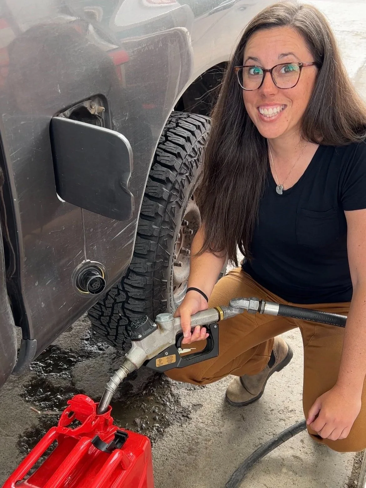
We made a fuel stop just before getting on the Cassiar to fill our 2 10L (5gallon) fuel cans so that we could carry a total of 36 gallons of fuel. That additional capacity would mean that we could skip some of the smaller much more expensive fuel stations along the way.
Settling into our first day of driving, we made progress very quickly. The road, despite its relative remoteness is in very good condition and is paved the whole way, however often without any painted lines. Our first camp along the Cassiar was just a short drive off the main pavement and aside from the overwhelming amount of mosquitoes that also called it home, it was a very quiet and peaceful place to stay for the night.
While we were in this spot we got to add another first time experience to our list. We were finally far enough north that the summer night sky never got fully dark. Even though the light did get really low in the late (like around 2 am) hours of the night, there was still enough light hanging in the northern sky that it prevented us from seeing any stars at any point in the night. It would be many weeks before we saw stars in the night sky again!
The long hours of light also mislead us into thinking that it was much earlier in the evening than it actually was, resulting in us accidentally crawling into bed nearly 2 hours later than we would have normally. Once in bed, the light again kept us away from sleep as we found ourselves peering out of our Go Fast Camper tent to check for larger critters such a grizzlies, or moose, but also to soak in the still illuminated scenery. Eventually our heavy eyelids took over and around 1:30am on our first “White Night” we finally fell asleep under a still light blue sky.
The next morning, we setup our Starlink satellite internet so that Christina could finish up her last day of work before taking some vacation time that would allow us to cover the remaining ground to Tuktoyaktuk. Starlink has proved itself many times over on this trip, however this spot would be the last that we could use it until we returned to this same latitude in the fall, since at this time (Summer 2022) Starlink’s service only works up to latitude 56°. Beyond that latitude we were uncertain of the reliability and speed of the cellphone coverage that we’d have until we’d get to Palmer, AK. So to play it safe and enjoy our time in the remote arctic, Christina decided that it was best to take a little time off of work.
Our second driving day along the Stewart-Cassiar was rather rainy which gave us some good motivation to spend some extra time in the driver and passenger seats of the truck and to chip away some big milage days so that we could stay on track with our timeframe. With the additional cloud cover we didn’t find ourself jumping out of the car too frequently. Often the views of peaks were obstructed by thick blankets of clouds but we made a few stops along the way whenever a small window would open up.
We were able to get out and break the drive up into several manageable portions. We would fill our fuel tank whenever possible, and take that opportunity to make a road side salad or PB&J.
One of the stops that helped us break up our drive was the first vehicle recovery that we performed while on this trip. A delivery driver bringing food supplies to a nearby mining camp had in a lapse of attention slipped his right wheels off the pavement. Wet conditions and a steep shoulder prevented him from getting out of the ditch on his own.
With few other cars on this stretch of road, we decided to pull over and see what we could do to help. Thankfully he had managed to keep his truck upright and wasn't far from the road surface. We made a little walk around the vehicle to make sure that we would be able to successfully assist him without further damaging his truck or causing any damage to ours either. After our walk around we decided that pulling him back on to the road surface was going to be rather easy and safe to do. So we connected the two trucks together with a recovery strap and gave him a gentle tug back to flat pavement, and he was back on his way.
We figure that you never know when you might be in need of assistance so we always try to lend a helping hand when we can.
This portion of our trip proved to offer the most wildlife viewing that we’d had yet. We counted eight Black Bears along this section of road. Most were all feeding on grasses and berries just within the shoulder. They were so preoccupied with snacking that they hardly noticed us pulling over to make some photos of them.
With so much extra daylight, we broke our cardinal rule, and drove on until about 10pm (which looked more like 6pm) before we began looking for a place to camp for the night. We spotted some beautiful Caribbean blue lakes just south of the Yukon border and figured we’d check the area out. Unfortunately, if you stayed sealed inside your vehicle, and only peered through the glass of your windows you’d be safe, but this area proved to have the most horrendous mosquitos we’d ever encountered.
Armored head to toe against mosquitos with head nets, Gore-Tex jackets, Carhartts, and rain boots, we took a deep breath, and stepped out of the truck. At first it didn’t seem too terrible. I mean, there were a lot of mosquitos, but we thought it might be ok. So we got Greta out of the truck to go potty before jumping in bed, and that poor dog was instantly swarmed and was pawing at her face and snapping at the ones biting her rump. We figured we had to move quickly and get in the truck as fast as possible so before popping the top on the Go Fast, we tossed Greta into the back of the truck and quickly climbed in after her and shut the hatch behind us. To our horror, sitting there in the dark bed of our truck, all we could hear was the scream of hundreds of mosquitos. When we turned on a headlamp we confirmed that there was no way we were going to be able to deal with THAT many mosquitos in our truck. So, we bailed out the back of the truck, and quickly jumped back into the cab. We rolled the windows down to try to expel as many mosquitos from the cab as we could while we drove, still wearing our head nets.
We ended up finding a slightly less horrendously mosquito infested spot to call home for the night but we still spent over an hour killing mosquitos inside the GFC and Christina even slept in her bug head net for the sake of sanity. Good times. Amid the mosquito hell, we didn’t manage to snap any photos but in retrospect, we now have excellent perspective on how bad the mosquitos can get. :)
The next morning, just a few miles before the end of the Cassiar highway we crossed into Yukon, Canada. This is one of three territories and provinces that we would cross through on our way north. Formerly called Yukon Territory and sometimes referred to as The Yukon, it's the smallest and westernmost of Canada's three territories. It also is the second-least populated province or territory in Canada.
At the end of the Cassiar we broke from our drive north to make a small detour east to visit what has become a must-stop for many travelers, The Sign Post Forest.
In 1942 a homesick GI, Carl Lindley, who was working on the construction of the Alaska Highway, was ordered to repair a sign and decided to personalize the job by adding a sign of his own pointing towards his home town, Danville, Illinois. Since that point, travelers have continued to add their own signs. Ranging from license plates, to dinner plates to any other creative “sign”, each with a short note and their origins. Currently, it's estimated that over 77,000 signs make up the forest.
Knowing that' we’d pass through this spot, we’d carried our own sign from home to contribute to the collection. The sign we chose to add was the front license plate from our 2003 4Runner which had been gifted to us from Christina's parents. They had owned it since it was brand new and together they had all shared countless memories and nearly 200,ooo miles in it long before it was passed down to us. Once we received it, we quickly built a small platform in it (like we have done with nearly every vehicle we have owned) and set off using it as our new-to-us travel and adventure rig. A lift and larger tires soon followed and the doors for further vehicle-based travel opened even wider. We never fully called that truck home in the sense of living in it, but it quickly became home for us on the weekends and on vacations. It was instrumental in setting us on the course that we are on currently and we enjoyed many years of travel with that truck and still think about it often. An unfortunately icy intersection and resulting car accident brought our time with that beautiful green hunk of metal to an end. For all that it taught us and the all the adventures it inspired in us, we are forever grateful to have had the time with it that we did. It only seemed fitting to bring a piece of that little green 4Runner with us to add to the Sign Forrest amid what is now our biggest adventure yet.
Departing from the Sign Post Forest we stopped in the nearby Watson Lake visitor center. The visitor centers all throughout this area of Canada provide critical update information about the few roads and their current conditions in these areas. We had heard rumors about a wildfire north of us along our planned route and after chatting with an amazing visitor center employee by the name of Button, we learned that there were indeed several fires burning along our planned route. She informed us that 136 fires in total had been started as a result of lightening strikes from a recent storm and let us know that they had placed most of that surrounding community on pre-evacuation notice also that they had closed the road the day before but that day the road was open and a pilot car was allowing people through. She also gave us confidence that they would likely have the road open in a day which lined up with our timing of when we would arrive close to where the fires were located just south of Pelly Crossing.
After a lengthy chat with Button, we had gathered enough information that we decided to proceed to Whitehorse, YT. From there, depending on the road conditions we would have to make one of three route choices. Ideally, we’d be able to drive the 533km stretch north from Whitehorse to Dawson City as we’d originally planned. If that route was no longer an option, we might have to make a big 920 km detour into Tok, Alaska and then come back into Canada on a route that would bring us into Dawson City from the west. Or other option was sitting still and waiting for the road to potentially re-open, but that didn’t seem like much fun either.
Armed with new knowledge and some route options to consider we crossed our fingers hoping for the best, jumped back into Dolores and set off for Whitehorse, Yukon.
Thanks for following along! We can’t wait to share the next leg of our trip with you all!